The Luck of the Irish

Thursday, December 15, 2011

Was Ireland always so perfect?
Current:
Dublin, Ireland currently reflects the climatology of a maritime climate with the Gulf Stream helping moderate its temperatures. Highs for Dublin currently range anywhere from 23 to 59 F, and the lows range anywhere from 12 to 51 F. The annual precipitation in inches is about 0 annually and the country of Ireland only sees on average 10 days of snow a year, if that.
Lat: 53.4 N and Long: 6.3 W ( Dublin, Irealand is located right about where the word "Europe" appears.)


Current Climograph of Temperatures and Precipitation: As you can see on this graph Dublin sees a good amount of their rain fall in the winter months and sees less in the summer when the temperatures are warmer.


100,000,000 years ago:
About a hundred million years ago the earth was in the late Early Cretaceous period (105Ma) and it was during this time that most of southern England was under water as it said the Atlantic Ocean had grown larger at this time. They base this fact off the chalk cliffs in Southern England which contain fossils of sea life. Some these same white chalk cliffs can be found in North East Ireland.
Based off of this information and the close proximity of Ireland to Southern England, I believe that the island of Ireland was also underwater as well at this time, and the only information that I have to dispute that guess is an article that states that a tiny portion of the island of Ireland was above water while the rest was submerged.

“Only a tiny portion of the landmass we know as Ireland today was above the water surface, a small, remote island situated on what would eventually become the eastern part of the county of Wicklow.” Article Source: http://EzineArticles.com/6039859

So based off this information, I would have to say that the climate of Dublin a 100 million years ago was oceanic and full of sea life, and I would also say based off the research and the fact that this era is right before an ice age that the ocean are much warmer and the Gulf Stream is slowly beginning to slow down as the temperatures of the oceans increase.
Lat: 52N Long: 8W
Based off the notion that 98% of Ireland is submerged and where Ireland is located today, the  I believe that Ireland was located 100 million years ago in the area above the equator between the continents near the light blue water.


Based on what I have read about this era temperatures for the ocean were a lot warmer than they are today, I guessed that in the winter months the water would be colder due to the amount of sunlight but in summer the temperatures would be up in the 70’s to 90’s because of extended hours of sun and based off the fact that temperatures of oceanic water reached into 100’s during this period.
http://en.wikipedia.org/wiki/Cretaceous


100 Million Years from now:
Based on what I have read, in 100 million years from now the mid-Atlantic ridge will begin subducting the ocean floor at a faster rate bringing the continents together—just like Pangaea. What this means for my location is relocation to above where Europe currently sits, near the North Pole. If this event does occur, it would mean a complete climate change. I would guess that with its location moving farther north would change this moderate climate to a much colder climate with temperatures falling below 20F on a daily basis. I would say that there would be much more snow then is currently seen in Ireland today—which is 10 days—and get about 2 to 3 inches of precipitation annually which is higher than it is today.


I borrowed this image from the blog on France since Dublin was in the same region.
This images shows that all of Northern Europe moved further north closer to the North Pole.


In this image you can see England up near where the North Pole is, and since Ireland and England were close in proximity my guess is that as England moved further north so did Ireland. As for the longitude and latitude I would imagine it would be around 4 or 5 N and 10 to 15 W.


Based on Ireland being further north, I imagine the amount of precipitation to increase as the snowfall would increase. I also believe the temperatures will drop significantly in the negatives because of its new polar nature.


Word Count: 731

Citations:


http://www.scotese.com/future1.htm

http://www.youtube.com/watch?v=uGcDed4xVD4


Monday, December 12, 2011

Dublin vs Paris

There are two places that I have always wanted to visit: Dublin, Ireland and Paris, France. Which lucky for me, they both share the same moderate, temperate weather conditions.
Looking at the historical data for the temperatures for these two locations, it shows Dublin’s highs falling between 23 and 59 and Paris’s falling between 23 and 62, and the lows being anywhere between 12 to 51 in Dublin and 14 to 51 in Paris. There isn’t much difference in the spread of high or low temperatures for these two locations, and that is because they are both moderated by the Atlantic ocean.


But one the main differences between the two locations is the fact that Paris lies inland and Dublin lies directly on the coast. For Dublin most of the moderation of temperatures comes from the proximity to the Gulf Stream, and for Paris there is moderation by the Gulf Stream to the West, as well, but the climate is also affected by the proximity to the continental climate to the East.


This is the source of air masses for Dublin, Ireland.


This the source of air masses for Paris, France.
Both of these areas are affected by the same air masses, but that is not all. They also share the same Koppen-Geiger climate rating of Cfb: warm temperate, fully humid, warm summers.


After looking online and at the other student’s blog, I have not found any real differences in climate. There are slight differences in elevation: Dublin at 279 feet and Paris at 358 feet and there is also the fact that Dublin is dominated by west-south-west winds that range between 4 to 32 mph and Paris is dominated by southwest winds that range between 3 to 26 mph.


This is a topographic map of Dublin, Ireland.


This is a topographic map of Paris.
From the topographic maps, it is clear that the biggest difference between the two locations if the topography. Ireland has minimal mountain or hills and few rivers whereas Paris seems to have a much more diverse topography and more rivers, but both of these topographies are dependent on their locations, Paris again being continental and Ireland coastal.

Word Count: 365

Citations:

http://www.google.com/imgres?q=map+that+denotes+both+Dublin,+Ireland+and+Paris,+France&um=1&hl=en&biw=1024&bih=494&tbm=isch&tbnid=s3kfHNOfc48NdM:&imgrefurl=http://langcafe2.myfreeforum.org/archive/location-location-location__o_t__t_178.html&docid=PZHYjNOj8qzFEM&imgurl=http://www.lefrancaisfaceaface.com/share/map_transports-329x326.gif&w=329&h=326&ei=CC_hTseSM9OnsQKh2_zNBg&zoom=1&iact=hc&vpx=599&vpy=142&dur=239&hovh=223&hovw=226&tx=119&ty=184&sig=116309746359193719238&page=22&tbnh=124&tbnw=125&start=232&ndsp=10&ved=1t:429,r:3,s:232
http://www.google.com/webhp#sclient=psy-ab&hl=en&site=webhp&source=hp&q=how+far+is+dublin%2C+ireland+from+paris%2C+france&pbx=1&oq=how+far+is+dublin%2C+ireland+from+paris%2C+france&aq=f&aqi=&aql=&gs_sm=e&gs_upl=2311l19950l0l20581l53l40l3l6l7l0l801l7229l2.21.7.3.1.0.1l44l0&bav=on.2,or.r_gc.r_pw.,cf.osb&fp=533a712cc6ce8ba0&biw=1024&bih=494

http://www.met.ie/climate-ireland/climate-of-ireland.asp

http://www.weather-forecast.com/locations/Dublin

http://www.weather-forecast.com/locations/Paris

Thursday, December 1, 2011

Climatology

When it comes to the climatology of Dublin, I found myself asking, “Why is it that this ‘island’ experiences moderate maritime climate and other regions at the same latitude experiences colder climates?”

Notice how Ireland is colored in the darker green on this map and how that color corridinates with Cfb according the scale.

Ireland in general is according to the Koppen/Geiger classification scheme is classified as a Cfb climate. According to this classification we see that Ireland which is located at 53N 20’ N and 6 16’ W is considered a warm temperate, fully humid, warm summered climate, and if you compare this to locations that fall at the same latitude in Canada (which we know in general tends to have colder winters) you start to wonder why is this?


In this map of Ireland we can see that it is fully surrounded by water on all side, and if you notice Dublin is located on the Eastern coast closest to the Irish Sea and English Channel.

First off Ireland is surrounded by two large bodies of water—the Atlantic Ocean and the Irish Sea, but you might wonder how it so warm in Ireland when appears to be a fair distance from the equator lying at 53 N? This is because of the warming influence of the North Atlantic current.

Ireland is not only surrounded by water but is in close proximity to the movement of warm water which allows for it be warmer than places in Canada which tend to be nearer colder bodies of water and have larger land masses.


This images shows us the amount of sunlight Ireland recieves at different times of year which can vary between 8 hours at most in summer and 3 hours in the winter; however, most of the time Ireland has a fairly thick layer of clouds that block out most of the sun's rays.


So we now have an idea of why Ireland experiences such temperate conditions, but is it that Irelands temperatures never reach into the 70’s or 80’s even though the humidity on the ‘island’ tends to be into the 90’s? Well according to the information I have found this has a lot to do with the fact that Ireland is located farther away from the heating of the equator, but it has more importantly to do with the amount of sunlight or solar radiation that penetrates Ireland.


This is another image that shows the average sunshine in Ireland.


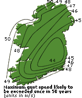
Other factors effecting Ireland are wind, rain, and cloud cover. Rain and cloud cover the last few years have remained about the same over the last few years, but when it comes to wind Ireland has seen some high winds and on November 30, 2011 was under a tropical warming watch for Invest 90 and also a high wind advisory.


Both of these images show the movement and intensity of Invest 90 in relation to Ireland.


In 2011, Hurricane Katia touched down in Northern Ireland bringing wind speed up of 80mph across Ireland. This hurricane swept across the northern part of the country destroying houses and buildings. The effect this hurricane had on Ireland was due to the fact that Ireland topography is generally flat especially compared to the mountainous region of Colorado.


In this image we see the movement of Hurricane Katia, and it's relation to Ireland.


The prevailing winds in Ireland come up from the south and west bringing warm air. For those in Dublin, these winds are minimal compared to other parts of Ireland because of the Mountians in located south of Dublin.


In these two images you can see the movement of the wind across Ireland.


Work Cited:
http://www.wunderground.com/tropical/tracking/at201190_model_intensity.html
http://www.wunderground.com/tropical/tracking/at201190_ensmodel.html
http://www.met.ie/climate-ireland/sunshine.asp
http://www.guardian.co.uk/uk/2011/sep/10/britain-braces-itself-for-storms-and-floods
http://www.irelandmapxl.com/climate-map.html
http://www.galway.net/about/weather/
http://www.met.ie/climate-ireland/wind.asp

Tuesday, November 15, 2011

Navaree, Florida vs Dublin, Ireland

Reflection:
For my reflection, I wasn’t sure what type of location would be best to compare Dublin, Ireland to but as I was looking through the list of locations I started to think about how Dublin is considered a maritime climate. Then I saw that Navarre, Florida is also considered a maritime climate, but these two locations seem to see very different ranges of weather.
Dublin temperatures never exceed 68 in the summer or drop below 30 in winter, but Navarre temperatures can reach into the 90’s in the summer and can see temperatures below anywhere from 5 to 60 in the winter.
The main reason for that is because of where they are located—Dublin is located at 53.4 N and 6.3 W and Navarre is located at 30.5 N and 86.9 W—and the currents that are dominate in this areas.

http://www.sistersofmercynf.org/ourstory/default.cfm?loadref=36

Navarre is located near the northern gulf coast and the Gulf of Mexico. Warm, wet air is brought up from the Gulf –stream ocean current causing summers to be hot and humid in Navarre. Navarre sees limited amount of continental polar air, but when it does temperatures can get below freezing.

http://navarreflweatherblog.blogspot.com/

Dublin is located near the Irish Sea and the northern portion of the Atlantic Ocean. Cold, dry air come across from the Polar Continental and warm, dry air comes up from the Tropical Continental causing the temperatures to remain mild in the summer.


http://www.met.ie/climate-ireland/climate-of-ireland.asp

But the elevations of these two cities are very different. Dublin sits at an elevation of 279 ft above sea level and Navarre sits at 102 ft above sea level. The warm wet air coming off the gulf-coast can easily sweep across Navarre as it lower in elevation and closer to sea level than Dublin which sits up higher and whose landscape is dominated with cliffs.
One of the similarities, that I am not sure how to decipher, is the amount of humidity in the air. Dublin has a normal humidity of 90, but it never gets above 70. Navarre has a normal humidity of 95, and its temperatures can reach into the 100’s. Why is this?
My theory is that it has to deal with the amount of clouds and the amount of sun light reached in each region. If I am correct, Navarre sees more sunlight than Dublin because of its closer proximity to the equator.


Word Count: 398

Tuesday, November 1, 2011

What influences the moderate weather in Dublin?

Dublin sees somewhat abrupt changes in weather—one day being cool and dry and the next being cold and wet—due to the fact that it lies underneath a convergence zone of cold air, warm dry air, and warm wet air.

http://www.met.ie/climate-ireland/climate-of-ireland.asp
As you can see in the image above, Ireland location—“50º and 60º north of the Equator and around 15º south of the Arctic Circle” —places in the middle of five different streams of air flow, and since it is an island the effects are greater due to the surrounding oceans
and its smaller land mass.


Dublin’s close proximity to both the Irish Sea and the Atlantic Ocean play a significant role in the moderate maritime climate that this beautiful region of Ireland sees. Ireland is affected mainly by air coming from the North Atlantic drift—the eastern extension of the Gulf Stream, but it affects the areas bordering the Atlantic coast line more so then the areas within the continent as the mountains and cliffs along the coast act as a shield from the winds. Due to the close proximity of the North Atlantic drift in winter, Ireland tends to a have more windy and cool climate than in the summer when the drift reaches farther North.
The weather in Ireland can at time shift abruptly if the polar front shifts in position—the polar front acts as transition zone for cold, dry air which is moving southwards and warm, wet air which is moving northwards.

http://www.met.ie/climate-ireland/climate-of-ireland.asp
In this image, we see one of the other major factors in Dublin’s moderate climate, the Polar front.
If you look at when the purple line circles around the L in upper right, you will see the red line of
warm air moving north converge with the blue line of cold air moving south.


Dublin located on the eastern coast experiences some of the driest weather in Ireland due in part to its distance from the Atlantic Ocean and the fact that most of the air Dublin receives comes from the Polar Continental flow—which is cold, dry air—and the Tropical Continental flow—which is warm/hot, dry air.


Seasonal Average Mean Sea Level Pressure
http://www.met.ie/climate-ireland/pressure.asp
In the image above, you can see how the pressure is lower in winter and autumn as the isobars are closer together
and in summer and spring the isobars spread out as the pressure tends to be higher during these seasons.


http://www.weather-forecast.com/static_maps/Ireland/wind/12
In this image, you can see the air/ surface winds coming up from the south—the warm, wet
tropical maritime air—moving along the western coast of Ireland and only a small amount
making in it east towards the Irish Sea and Dublin.


http://www.weather-forecast.com/static_maps/Ireland/cloud/12

In this image, you can see that most of the clouds lie over the Atlantic Ocean and southwest or northeast from Dublin.

Thursday, October 13, 2011

Dublin's Basic Climatology

Have you ever dreamed of that perfect place to live? I have, and that place, for me, has always been Ireland more specifically Dublin. For one, it is the home of my ancestors and two it is home to my ideal climate. The coldest day on average is around 32 degrees Fahrenheit and the hottest on average is 68 degrees.
Dublin, Ireland has a maritime temperate climate as Dublin is located on the eastern coast of Ireland bordering the Irish Sea. The hottest temperatures fall in July and August, and the most precipitation occurs in December. The wettest areas or the areas that get the most rainfall in Dublin are located near the mountains.
Dublin though it has a wetter, more humid climate only sees 30-40 inches of rainfall a year and only sees about 10 days of snow a year. This lack of snow is the only downfall to its otherwise perfect climate. A climate where in 2000 the minimum temperature was 39 degrees Fahrenheit, a record low, and where in 2001 the maximum temperature was 66 degrees , a record high. In Dublin the record amount of precipitation was noted at -0 according to EIDW at weatherunderground.com.
Dublin has a very interesting climate as it can have anywhere from 80 to 95 degrees of humidity but the temperatures typically never rise above 68 degrees. But, if you were in any eastern coastal region in the US the temperatures can reach into the 90’s. So why is Dublin different?

Word Count:250


Source:
http://www.wunderground.com/history/airport/EIDW/2011/10/11/DailyHistory.html?req_city=NA&req_state=NA&req_statename=NA&MR=1


Source:
http://www.wunderground.com/NORMS/DisplayNORMS.asp?AirportCode=EIDW&SafeCityName=EIDW&StateCode=&Units=none